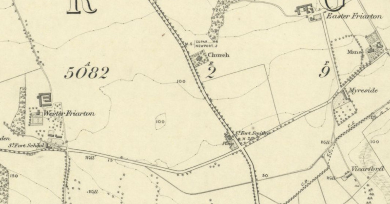
Forgan-Parish-Church-OS-Map.png
Dublin Core
Title
Forgan-Parish-Church-OS-Map.png
Description
Forgan Parish Church and its location near the road and the local smithy. Ordnance Survey Map of Fife, 1855
Contributor
Dante Clementi
Format
image/png
Type
Still Image
License
In Copyright (InC)
Medium
National Library of Scotland
Europeana
Europeana Type
IMAGE
Still Image Item Type Metadata
DescriptionEN
Forgan Parish Church and its location near the road and the local smithy. Ordnance Survey Map of Fife, 1855
Citation
“Forgan-Parish-Church-OS-Map.png,” Virtual Museum, accessed December 14, 2025, https://sacredlandscapes.org/omeka/items/show/676.
Embed
Copy the code below into your web page
