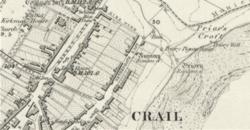
The site of the supposed ‘nunnery’ on Nethergate – perhaps in reality a medieval chapel. (Source: 1855 Ordnance Survey Map of Fife, sheet 20. Available at: https://maps.nls.uk/view/74426837)
Dublin Core
Title
The site of the supposed ‘nunnery’ on Nethergate – perhaps in reality a medieval chapel. (Source: 1855 Ordnance Survey Map of Fife, sheet 20. Available at: https://maps.nls.uk/view/74426837)
Contributor
Bess Rhodes
Format
image/jpeg
Type
Still Image
Europeana
Europeana Type
IMAGE
Citation
“The site of the supposed ‘nunnery’ on Nethergate – perhaps in reality a medieval chapel. (Source: 1855 Ordnance Survey Map of Fife, sheet 20. Available at: https://maps.nls.uk/view/74426837),” Virtual Museum, accessed December 14, 2025, https://sacredlandscapes.org/omeka/items/show/448.
Embed
Copy the code below into your web page
